Introduction

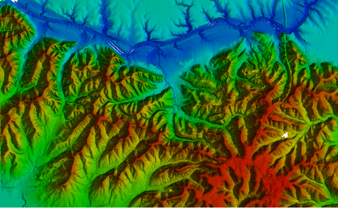
Global Mapper is a map drawing software that not only displays data (such as SRTM data) as raster maps, elevation maps, vector maps, but also allows for map editing, conversion, printing, GPS recording, and GIS (Geographic Information System) functions that utilize data, Version 6. xx has added the ability to directly access the USGS (United States Geological Survey) satellite photo TerraServer database and the topographic maps inside Global Mapper, as well as view elevation maps in a realistic 3D format.

Use to
A software that browses, synthesizes, inputs, and outputs most popular scanned raster maps, contour lines, and vector datasets. It can edit, convert, and print various map graphic files, and utilize geographic information system (GIS) information resources. It can convert the projection method of the dataset to match the coordinate system of your project, and can also crop the range of the dataset at the same time. It also provides distance and area calculations, raster blending, contrast adjustment, altitude query, line of sight calculation, as well as advanced functions such as image correction, contour generation from surface data, image mosaic, watershed observation from surface data, conversion of 3Dpoint data to triangular polygons, and meshing. Repetitive tasks can be efficiently completed through built-in scripting languages or numerous batch conversion options.